Over the next few months it is hoped to add information, stories and memories of people and places in the neighbouring towns and local townlands.
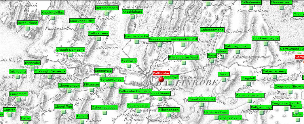
A larger version of the map displayed below is available at: Mayo County Library
If you would like to contribute information you can add it yourself using the Contribute button at the top of the page.
The Townland
The basis of all Irish land divisions is the townland and is the essential ingredient for successful research in Ireland. Whether it is an estate, a house, a farm, a family, or an archaeological site it is essential to have the name of the relevant townland.
A townland is the most ancient and the smallest official division and was originally based on ‘ballyboes’; an area of land deemed sufficient to sustain a cow. Many townlands share the same name, so it is also essential to find the Barony in which it is located e.g. Rathkelly is in Ballinrobe but its Barony is Kilmaine. Rathkelly, like many other townlands, was named at an early period with the name frequently derived from some local physical feature or landmark such as a mountain, bog, forest, a village, or a church, and in the case of Rathkelly by a ringfort.
Survey
A survey by the Ordnance Survey was carried out in 1830, with the names being standardised and recorded, with some townlands being of less than one acre and others of several thousand acres.
Names altered
The original name were sometimes altered or in some cases becoming modified as a result of English speaking clerks writing the names as they heard them, using the Latin alphabet to approximate Gaelic word sounds.
The Ordnance Survey completed in 1846, contains maps at the scale of six inches to the mile of each of the 60,462 townlands in Ireland. An index to these was published by Alexander Thom in 1861 and reprinted by the Genealogical Publishing Company in 1981 under the title
GENERAL ALPHABETICAL INDEX TO THE TOWNLANDS AND TOWNS, PARISHES,
AND BARONIES OF IRELAND.
When testifying before the Select Committee on County Cess, Griffith was asked whether the boundary of a townland is the boundary of a parish, are the boundaries in any degree commensurate? He responded:
“The boundaries of parishes are always boundaries of townlands; that is to say, one townland cannot be contained in two parishes; it sometimes happens that an estate may lie on both sides of the boundary of a parish, and that the townland in each parish is called by the same name, and is considered to be one townland, but in such cases I have always divided the townland, and added the word upper or lower, east or west, to the original name, to serve to distinguish them. As each parish will be separately assessed, it is necessary that no confusion should arise as to the boundaries of any denomination or division belonging to it, consequently in all cases the boundary of a parish must likewise be the boundary of a townland as far as that parish or the county assessment is concerned.’ “
Griffith’s Valuation
Richard Griffith carried out The Primary Valuation of Ireland. He had been appointed Boundary Commissioner in 1825 and Commissioner of Valuation in 1830. Between 1847 and 1863, both he and his team of valuers, travelled around the country surveying county by county
The results were published between 1848 and 1864 and arranged by county, barony, Poor Law Union, civil parish and townland. These include an assessment of the value for every property within those boundaries. The name of each occupier is also recorded.
Land was rented out using the name of townlands. They were used as a basis of census returns from 1821 and in rural areas still used as the postal address for mail deliveries.
A useful site for checking out an Index of Townlands is https://www.townlands.ie/

No Comments
Add a comment about this page